| Home Page
specs
gallery
recipes
recipes for disaster
links
step right up......
reach out
the devil makes work for idle hands........
KITCHEN-EYE
blast from the past ...
source
|
Off on the trail of James Brindley.......
The conception of the plan to link Birmingham and Oxford by canal was indeed James Brindley's,and the surveying of the route from Hawkesbury Junction in Coventry, and Hillmorton,hugging the 300 foot contour as it does is typical of Brindley's methods.This walk follows the 18th century route of the Oxford Canal from where it diverges from the present line of the canal at Brownsover near Rugby,and takes us to the site of Brindley's aqueduct which carries the Old Oxford over the River Swift at Cosford. |
|
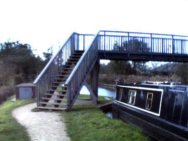
New Foot-bridge At Brownsover Junction(Old Oxford and North Oxford Canal)
Having attained the canal towpath from the ramp off the A426 footway,you see a wooden bridge over the canal to your left (looking under the span of the road bridge)We cross this bridge and follow the banks of the Oxford Canal under the new deck of the road bridge already much decorated with graffiti (some of which is attractive)A little further and the made up bath diverts away from the canal to climb over the old Brownover road. The canal passes below the arch of the bridge showing signs of its strengthening having been made into two , one for the waterway the other for foot access, presently not in use.
|
The old Brownsover road bridge
crossing the road and returning down the ramp to the towpath we are in the grounds of Brownsover Hall erstwhile seat of the Boughton Leighs, squires of the manors of Long Lawford, Newbold and Brownsover.In front of us the canal is crossed by abrick and masonary bridge which carries the drive to the front door of the hall.The hall itself is presently in use as a Hotel and bar accesscan be gained by crossing the bridge and walking up through the grounds.Meals, snacks, and drinks are available I am told.The towpath leads us onwards ,doggedly hugging the contours of the land,following the flank of the hill ever further from the River Swift some Quartermile distant from us horizontally although still 45 feet below us vertically. |
|
|
|
Left:---The accomodation bridge, Brownsover Hall
Therein lies the problem with contour engineering a canal.Although the vertical height above the river, (45 feet),was within the civil engineering skills of the day,there were none the less problems to surmount, the necessity for the construction of a lengthy embankment to maintain the level being the most pressing of these.So the canal was forced to take the long detour to Cosford to achieve the aim of hurdling the river Swift.There were also land ownership issues to settle,confounded by Brindley's notable absences whilst working on many projects simultaneously.The towpath wends it's way onwards skirting the treelined flank of the hill to your right whilst maintaining a roughly parallel course to the river Swift to your left.It passes beneath another accomodation bridge built to carry the bridle way to Coton over the navigation and carries on northwards to its eventual destination, Cosford. |
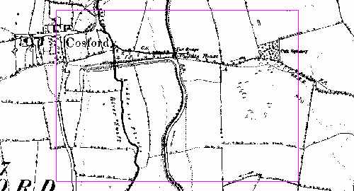
this map(right)shows the location of the Brindley aqueduct on the 1889 Ordnance Survey
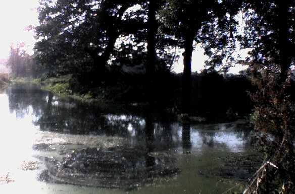
Eventually the waterway appears to peter out at a weir and sluice gate and footbridge over the water.This is the site of the "Puddle House" as shown on the map to the right.The small watercourse that carries onwards, is a feeder stream for the navigation and the purpose of the "Puddle House" to provide accomodation for the sluice keeper whose job it was to maintain water levels in the navigation.Looking left towards the river,the line of the Old Oxford is still clearly visible as a ditch between two earthen banks heading straight(unusually) accross the fields towards Cosford. This is our route onwards.
|
|
|
|
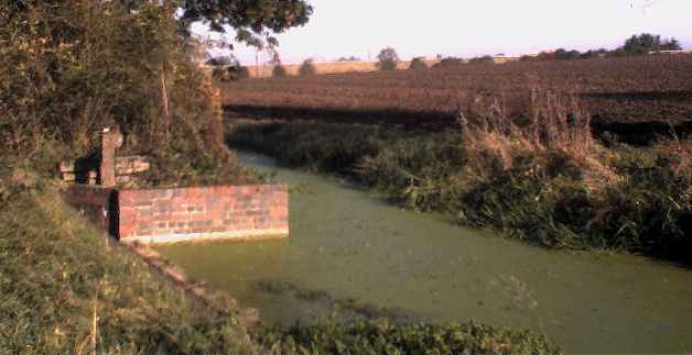
Site of the "Puddle House"and present end of the waterway
The building that stood here, a small brick structure, was built for the convenience and accomodation of the sluice keeper in the late 18th. century.It was still standing in 1963, although derelict and no longer habitable.It was demolished at a later date unknown to me,though the sluices remain in use to this day by B.W.B and the waterway is still technically navigable to this point although not open to normal waterways traffic (good project in there somewhere people!) |
The line of the old waterway is clearly discernable as it heads accross the fields towards Cosford and the River Swift.the scale of the architecture becoming rapidly apparent as the height of the embankment rapidly increases to some 25 feet when the aqueduct is reached.
right :--- Looking back towards Brownsover |
|
|
|
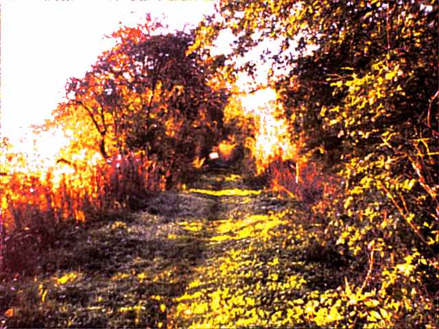
The line of the old towing path, looking towards Cosford.
Turning left, away from the water,the old towing path disappears in a morass of nettles and brambles . A clearly defined path however, continues
on what would have been the opposite bank of the waterway.There is a sculpted wooden bench placed here by the waterways board as part of the improvements made when the Oxford Canal Walk was adopted as part of the "heritage"network of foot and cycle ways.Much of the flood plain of the Swift
being managed as a wild park by the Warnact Trust.From this path the original dimensions of the Old Oxford Canal can still be descried,a dyke some 6feet deep and 16 feet wide.This runs in a straight line (unusually for the original cut)for approximately 600 yards.at it's highest point ,where
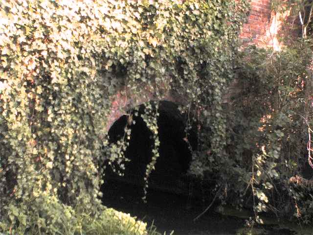
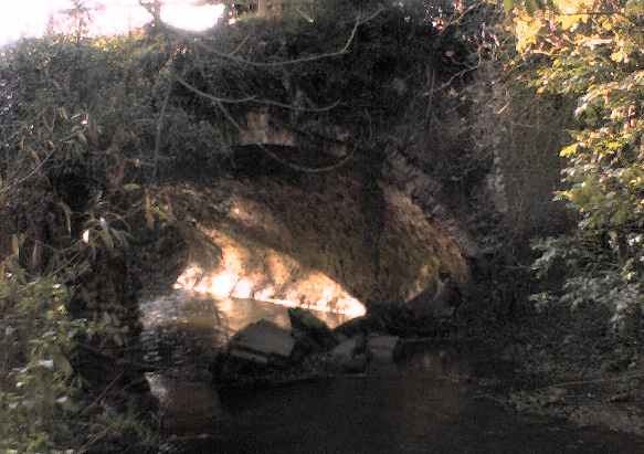
it becomes the aqueduct it is 25 feet above the mean water level of the swift.The aqueduct itself is a brick built structure of two arches,massively buttressed,built from 2 and a quarter inch x 4 inch x 8 inch brick stock this being the standard current at that time.Much of this brick stock is still evident in the archways as a testament to the durability of the material.The lime used was probably locally burnt as there was a limekiln at Newbold upon Avon further along the canal.I like to
think that the materials for the construction of this bridge were brought here by boat as the length of canal from Coventry predates this section, and Newbold would have been the closest source of lime and there was a wharf by the limeworks at the back of St.Botolphs church Newbold and The remains of Brindleys original redbrick tunnel can be seen there.The bricks, of a local stock,may well have been made at Shawell on the Watling Street,some 2 and ahalf miles distant,(a bridle way leads from the puddle house to Churchover and thence Shawell and would have provided a route for the bricks to be fetched)however I must caution the reader that this is speculative and unbacked by research.
|
The aqueduct-photograph,right- is now sadly neglected as can be seen.It carries the bed of the canal over the River Swift on two arches 15 feet high and strongly buttressed at both centres and ends.Much of the redbrick stock has been robbed away over the years and can be seen in the walls of the farm houses in Cosford village.Sufficient remains however to cross the Swift.Time is taking it's toll though and if efforts are not made to conserve the remains it may not survive for very much longer. |
|
|
|
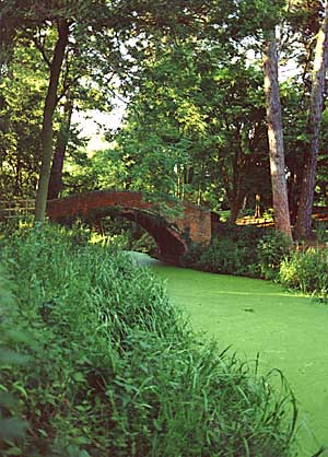
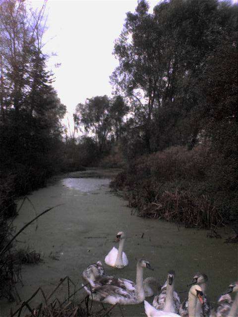
Traffic on The Old Oxford Canal(left)
|
ONWARDS!
|
|
|
|
|
|
|
|
|
|
|
|
|